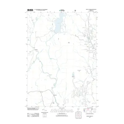
2012 Map of Mount Snow
USGS Topo · Published 2012About this map
Somerset Reservoir and the Searsburg Reservoir anchor the water-power landscape of this Windham County region, where the Deerfield River carves its way through the mountains. The area is defined by its evolution into a premiere winter recreation destination, with the large footprints of the Mount Snow Ski Resort, Carinthia Ski Area, and Haystack Mountain Ski Area dominating the eastern slopes. For genealogists, the map is a dense record of early settlement history, preserving the locations of numerous family and community burial grounds including Somerset Cem, Alden Cem, and Smead Hill Cem. Small centers like Somerset and Searsburg remain distinct, while the winding paths of Tannery RD and Vose Brook suggest the rugged infrastructure of earlier mountain industry. From the high peak of Mount Snow to the quiet of Shep Meadow, the map illustrates a landscape where traditional Vermont land use meets modern recreational development.
Find a feature on this map
72 named features on this map. Tap any name to fly to it.
Don’t see what you’re looking for? This feature index may not catch every label — zoom into the map to look around manually.
Map Details
Editions of this 2012 Mount Snow Map
This is the sole edition of this map. No revisions or reprints were ever made.
Other maps of this area

1889 · Wilmington
USGS Topo · 1:62,500

1891 · Wilmington
USGS Topo · 1:62,500

1894 · Londonderry
USGS Topo · 1:62,500

1894 · Equinox
USGS Topo · 1:62,500

1896 · Equinox
USGS Topo · 1:62,500

1898 · Bennington
USGS Topo · 1:62,500

1899 · Londonderry
USGS Topo · 1:62,500

1899 · Wilmington
USGS Topo · 1:62,500

1900 · Taconic
USGS Topo · 1:125,000

1900 · Equinox
USGS Topo · 1:62,500