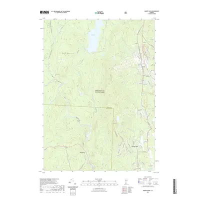
2021 Map of Mount Snow
USGS Topo · Published 2021About this map
Mt Snow and the peaks of the Green Mountains dominate this landscape within the Green Mountain National Forest, where the terrain transitions from rugged high-country peaks to the managed waters of the Deerfield River. The map documents a distinct geography of winter recreation and historic rural settlement, particularly visible in the southeastern corner at Chimney Hill and the recreational trails like Deerfield Ridge Trl and Binney Brook Trl.
Find a feature on this map
85 named features on this map. Tap any name to fly to it.
Don’t see what you’re looking for? This feature index may not catch every label — zoom into the map to look around manually.
Map Details
Editions of this 2021 Mount Snow Map
This is the sole edition of this map. No revisions or reprints were ever made.
Other maps of this area

1889 · Wilmington
USGS Topo · 1:62,500

1891 · Wilmington
USGS Topo · 1:62,500

1894 · Londonderry
USGS Topo · 1:62,500

1894 · Equinox
USGS Topo · 1:62,500

1896 · Equinox
USGS Topo · 1:62,500

1898 · Bennington
USGS Topo · 1:62,500

1899 · Londonderry
USGS Topo · 1:62,500

1899 · Wilmington
USGS Topo · 1:62,500

1900 · Taconic
USGS Topo · 1:125,000

1900 · Equinox
USGS Topo · 1:62,500