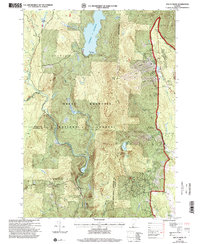
1997 Map of Mount Snow
USGS Topo · Published 2000About this map
The Green Mountain National Forest dominates this Vermont landscape, defined by the major recreational developments and water management systems of the late 20th century. The prominent Mount Snow Ski Area and Haystack Mountain Ski Area occupy the eastern ridges, while the vast Somerset Reservoir to the north and the smaller Searsburg Reservoir to the south regulate the flow of the Deerfield River.
Find a feature on this map
40 named features on this map. Tap any name to fly to it.
Don’t see what you’re looking for? This feature index may not catch every label — zoom into the map to look around manually.
Map Details
Editions of this 1997 Mount Snow Map
This is the sole edition of this map. No revisions or reprints were ever made.
Other maps of this area

1889 · Wilmington
USGS Topo · 1:62,500

1891 · Wilmington
USGS Topo · 1:62,500

1894 · Londonderry
USGS Topo · 1:62,500

1894 · Equinox
USGS Topo · 1:62,500

1896 · Equinox
USGS Topo · 1:62,500

1898 · Bennington
USGS Topo · 1:62,500

1899 · Londonderry
USGS Topo · 1:62,500

1899 · Wilmington
USGS Topo · 1:62,500

1900 · Taconic
USGS Topo · 1:125,000

1900 · Equinox
USGS Topo · 1:62,500