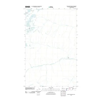
2011 Map of Mount Spickard
USGS Topo · Published 2011About this map
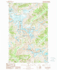
Mount Spickard and Mount Rahm anchor this high-elevation landscape along the Washington-British Columbia border. The terrain is defined by a network of drainage systems, most notably the winding courses of Little Beaver Creek and Big Beaver Creek. At the base of Custer Ridge, Silver Lake feeds into Silver Creek, which traverses the northern section of the quadrangle. A rare point of human infrastructure in this wilderness environment is the Perry Creek Shelter, located near the confluence of Perry Creek and Little Beaver Creek. Other distinct watercourses, including Mist Creek, Redoubt Creek, and Arctic Creek, emphasize the complex hydrology of the region. This 2011 survey, produced using data from the National Hydrography and Elevation Datasets, provides a precise look at the glaciated peaks and narrow valleys of Whatcom County.
Find a feature on this map
12 named features on this map. Tap any name to fly to it.
Don’t see what you’re looking for? This feature index may not catch every label — zoom into the map to look around manually.
Map Details
Editions of this 2011 Mount Spickard Map
This is the sole edition of this map. No revisions or reprints were ever made.
Other maps of this area

1953 · Mt Challenger
USGS Topo · 1:62,500

1955 · Concrete
USGS Topo · 1:250,000

1958 · Concrete
USGS Topo · 1:250,000

1962 · Concrete
USGS Topo · 1:250,000

1969 · Mt Prophet
USGS Topo · 1:24,000
1969 · Pumpkin Mtn.
USGS Topo · 1:24,000
1969 · Hozomeen Mtn
USGS Topo · 1:24,000
1969 · Mt Spickard
USGS Topo · 1:24,000

1979 · Mt. Baker
USGS Topo · 1:100,000
1989 · Mt Challenger
USGS Topo · 1:24,000