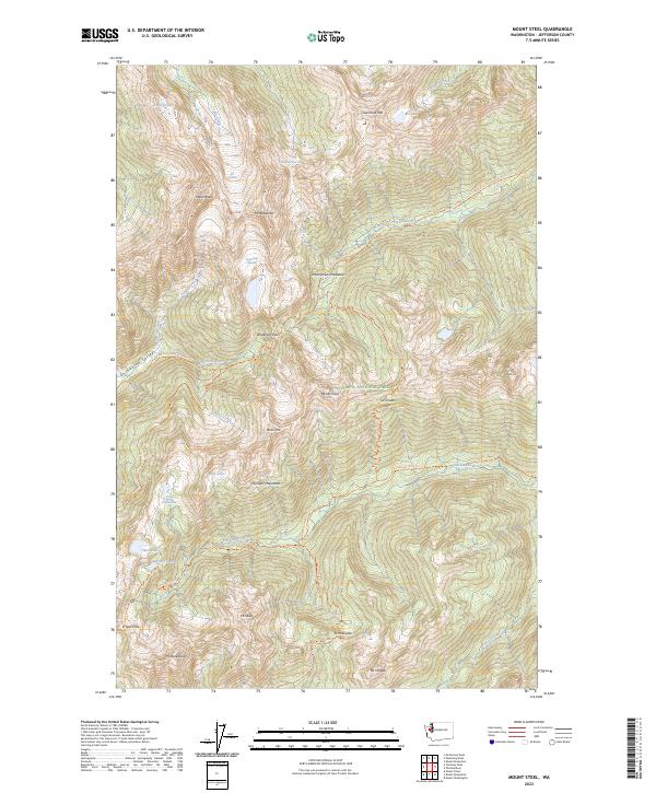
2023 Map of Mount Steel
USGS Topo · Published 2023About this map
Mt Anderson stands as the dramatic central hub of this high-alpine landscape, where glacial activity continues to shape the terrain of the Olympic Wilderness. Significant ice masses like the Eel Glacier, Hanging Glacier, and Anderson Glacier cling to the steep northern and southern slopes of the peak, feeding the headwaters of major regional drainages. The West Fork Dosewallips River and the Quinault River emerge from these heights, following paths carved through deep valleys. High-altitude meadows and passes, such as Honeymoon Meadows and Anderson Pass, provide natural conduits through the Olympic Mountains. Further south, Mt Steel and Mt LaCrosse dominate the skyline above Lake LaCrosse and Marmot Lake. The network of trails, including the East Fork Quinault River Trl and the Lacrosse Pass Trl, illustrates the long-standing access routes used to navigate this primitive interior of Olympic National Park.
Find a feature on this map
49 named features on this map. Tap any name to fly to it.
Don’t see what you’re looking for? This feature index may not catch every label — zoom into the map to look around manually.
Map Details
Editions of this 2023 Mount Steel Map
This is the sole edition of this map. No revisions or reprints were ever made.
Other maps of this area

1938 · Mt Constance
USGS Topo · 1:125,000

1944 · Mt. Angeles
USGS Topo · 1:62,500

1946 · Mt. Angeles
USGS Topo · 1:62,500

1946 · Tyler Peak
USGS Topo · 1:62,500

1947 · The Brothers
USGS Topo · 1:62,500

1947 · Mt. Steel
USGS Topo · 1:62,500

1948 · Tyler Peak
USGS Topo · 1:62,500

1950 · The Brothers
USGS Topo · 1:62,500

1950 · Mt. Steel
USGS Topo · 1:62,500

1958 · Seattle
USGS Topo · 1:250,000