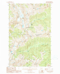
1990 Map of Mount Steel
USGS Topo · Published 1990About this map
Olympic National Park defines this 1990 survey, showing a landscape shaped by high-altitude glaciers and the headwaters of several major river systems. The map documents a network of primitive trails and backcountry shelters, such as the Duckabush Shelter and Home Sweet Home Shelter, which provided essential refuge for early wilderness travelers and rangers. Strategic mountain crossings like Anderson Pass and La Crosse Pass connect the drainage basins of the Dosewallips River, Quinault River, and Duckabush River. The presence of Eel Glacier and Anderson Glacier feeding into Iceberg Lake highlights the glaciated character of the Mount Anderson massif. For researchers of recreation history, the map preserves the location of historic stopping points like Two Bear Camp and the aptly named Honeymoon Meadows along the West Fork Dosewallips River.
Find a feature on this map
39 named features on this map. Tap any name to fly to it.
Don’t see what you’re looking for? This feature index may not catch every label — zoom into the map to look around manually.
Map Details
Editions of this 1990 Mount Steel Map
This is the sole edition of this map. No revisions or reprints were ever made.
Other maps of this area

1938 · Mt Constance
USGS Topo · 1:125,000

1944 · Mt. Angeles
USGS Topo · 1:62,500

1946 · Mt. Angeles
USGS Topo · 1:62,500

1946 · Tyler Peak
USGS Topo · 1:62,500

1947 · The Brothers
USGS Topo · 1:62,500

1947 · Mt. Steel
USGS Topo · 1:62,500

1948 · Tyler Peak
USGS Topo · 1:62,500

1950 · The Brothers
USGS Topo · 1:62,500

1950 · Mt. Steel
USGS Topo · 1:62,500

1958 · Seattle
USGS Topo · 1:250,000