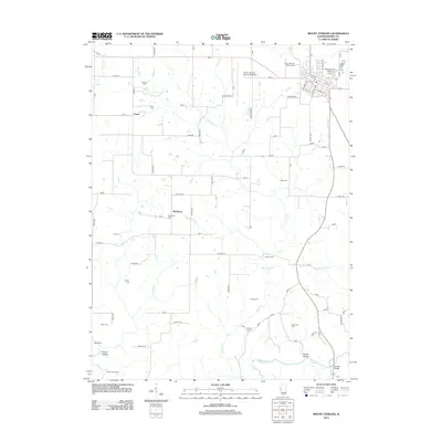
2012 Map of Mount Sterling
USGS Topo · Published 2012About this map
Mount Sterling City Cemetery and Mount Sterling Catholic Cemetery anchor the northern edge of this Illinois landscape, marking the established community of Mount Sterling. The map reveals a deeply rural county structure defined by a grid of numbered roads and named farm lanes that connect small clusters like Fargo and Buckhorn. Genealogy interests are well-served by the density of family-named burial grounds scattered across the terrain, including Cleaves Cem, Butler Cem, and Dearborn Cem. The southern reach of the survey is shaped by the winding course of McKee Cr and Dry Fork, where the elevation drops into Cronin Hollow and Sarrah Hollow. Infrastructure like the Mount Sterling Municipal Airport and the Gerrish Bridge across the creek show the modern developments alongside the older rural homesteads and camps such as Two Rivers Camp.
Find a feature on this map
71 named features on this map. Tap any name to fly to it.
Don’t see what you’re looking for? This feature index may not catch every label — zoom into the map to look around manually.
Map Details
Editions of this 2012 Mount Sterling Map
This is the sole edition of this map. No revisions or reprints were ever made.
Other maps of this area

1923 · Rushville
USGS Topo · 1:62,500

1926 · Rushville
USGS Topo · 1:62,500

1926 · Mt Sterling
USGS Topo · 1:62,500

1928 · Meredosia
USGS Topo · 1:62,500

1929 · Mt Sterling
USGS Topo · 1:62,500

1931 · Meredosia
USGS Topo · 1:62,500

1946 · Augusta
USGS Topo · 1:62,500

1948 · Quincy
USGS Topo · 1:250,000

1949 · Augusta
USGS Topo · 1:62,500

1956 · Quincy
USGS Topo · 1:250,000