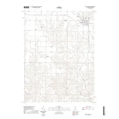
2021 Map of Mount Sterling
USGS Topo · Published 2021About this map
The Brown County Courthouse anchors the seat of Mount Sterling, where the town grid transitions into a landscape defined by deeply incised drainages and family cemeteries. To the south, the terrain becomes more complex as it descends toward McKee Creek and Cronin Hollow, with the Gerrish Bridge crossing the water near the southeastern corner. Small rural nodes like Buckhorn and Fargo are still identified, though they are now largely represented by their respective namesake burial grounds, Buckhorn Cem and the Mount Pleasant Fargo Cem.
Find a feature on this map
83 named features on this map. Tap any name to fly to it.
Don’t see what you’re looking for? This feature index may not catch every label — zoom into the map to look around manually.
Map Details
Editions of this 2021 Mount Sterling Map
This is the sole edition of this map. No revisions or reprints were ever made.
Other maps of this area

1923 · Rushville
USGS Topo · 1:62,500

1926 · Rushville
USGS Topo · 1:62,500

1926 · Mt Sterling
USGS Topo · 1:62,500

1928 · Meredosia
USGS Topo · 1:62,500

1929 · Mt Sterling
USGS Topo · 1:62,500

1931 · Meredosia
USGS Topo · 1:62,500

1946 · Augusta
USGS Topo · 1:62,500

1948 · Quincy
USGS Topo · 1:250,000

1949 · Augusta
USGS Topo · 1:62,500

1956 · Quincy
USGS Topo · 1:250,000