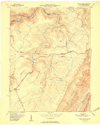
1951 Map of Mount Storm
USGS Topo · Published 1951About this map
Abram Creek and its many tributaries carve through the heart of this Appalachian landscape, where industry and community intersected in the mid-20th century. The Western Maryland railroad follows the winding North Branch of the Potomac River along the northern edge, serving the coal operations that defined the local economy. Extensive strip mining activity is documented across the uplands, particularly near Emoryville and north toward Oakmont. For genealogists and local historians, the sheet preserves the location of rural landmarks such as White Hall Sch, Rehoboth Ch, and Schaeffer Cem. The steep ascent of the Allegheny Front dominates the eastern section, with the George Washington Highway cutting a path through the settlements of Hartmansville and Mount Storm, providing a vital transit link across the ridges of Union and Elk districts.
Find a feature on this map
46 named features on this map. Tap any name to fly to it.
Don’t see what you’re looking for? This feature index may not catch every label — zoom into the map to look around manually.
Map Details
Editions of this 1951 Mount Storm Map
This is the sole edition of this map. No revisions or reprints were ever made.
Other maps of this area

1895 · Piedmont
USGS Topo · 1:125,000

1899 · Oakland
USGS Topo · 1:62,500

1900 · Oakland
USGS Topo · 1:62,500

1916 · Davis
USGS Topo · 1:48,000

1918 · Davis
USGS Topo · 1:62,500

1919 · Elk Garden
USGS Topo · 1:48,000

1919 · Davis
USGS Topo · 1:62,500

1920 · Elk Garden
USGS Topo · 1:48,000

1920 · Davis
USGS Topo · 1:48,000

1921 · Greenland Gap
USGS Topo · 1:62,500