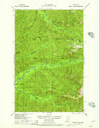
1957 Map of Mount Tom
USGS Topo · Published 1957About this map
The Soleduck River and Bogachiel River headwaters dominate this mid-century look at the high wilderness along the Clallam and Jefferson County line. The map highlights a remote network of trails and backcountry infrastructure within Olympic National Park and Olympic National Forest, including numerous high-altitude refuges like the Soleduck Shelter and the Happy Four Shelter. Near the northern border, Soleduck Hot Springs and Eagle G S mark early points of access into the interior, while the massive Mt Tom and Bogachiel Pk define the high ridgelines. The concentration of backcountry shelters such as Twenty One Mile Shelter and Big Flat Shelter illustrates the established trail system used by forest rangers and early hikers to navigate the river forks and glacial basins of the peninsula.
Find a feature on this map
54 named features on this map. Tap any name to fly to it.
Don’t see what you’re looking for? This feature index may not catch every label — zoom into the map to look around manually.
Map Details
Editions of this 1957 Mount Tom Map
This is the sole edition of this map. No revisions or reprints were ever made.
Other maps of this area

1918 · Lake Crescent
USGS Topo · 1:62,500

1919 · Port Crescent
USGS Topo · 1:62,500

1922 · Pysht
USGS Topo · 1:62,500

1922 · Lake Crescent
USGS Topo · 1:62,500

1935 · Mount Olympus
USGS Topo · 1:62,500

1939 · Mount Tom
USGS Topo · 1:62,500

1942 · Pysht
USGS Topo · 1:62,500

1942 · Mount Olympus
USGS Topo · 1:62,500

1943 · Spruce Mountain
USGS Topo · 1:62,500

1943 · Copalis Beach
USGS Topo · 1:250,000