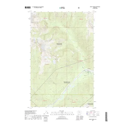
2020 Map of Mount Triumph
USGS Topo · Published 2020About this map
Newhalem sits at the heart of this high-alpine landscape, serving as a vital gateway along the Skagit River where hydroelectric history meets the wild terrain of the North Cascades National Park. The map detailing this region shows a dramatic elevation change from the river valley up to the sharp summits of Mt Triumph and Mt Despair. Local landmarks like Ladder Creek Falls and the Skagit River Loop highlight the recreational focus near the settlement, while the interior is defined by glacial drainages such as Goodell Cr and Thornton Cr. High-elevation features like Thornton Lakes and Trappers Peak illustrate the challenging geography that has historically isolated this part of Whatcom County. The transition between the Ross Lake National Recreation Area and the surrounding wilderness is clearly demarcated, showing the complex land management of this protected corridor.
Find a feature on this map
36 named features on this map. Tap any name to fly to it.
Don’t see what you’re looking for? This feature index may not catch every label — zoom into the map to look around manually.
Map Details
Editions of this 2020 Mount Triumph Map
This is the sole edition of this map. No revisions or reprints were ever made.
Other maps of this area

1953 · Marblemount
USGS Topo · 1:62,500

1953 · Mt Challenger
USGS Topo · 1:62,500

1955 · Concrete
USGS Topo · 1:250,000

1958 · Concrete
USGS Topo · 1:250,000

1962 · Concrete
USGS Topo · 1:250,000

1963 · Eldorado Peak
USGS Topo · 1:24,000

1963 · Diablo Dam
USGS Topo · 1:24,000

1969 · Mt Prophet
USGS Topo · 1:24,000

1979 · Mt. Baker
USGS Topo · 1:100,000
1989 · Marblemount
USGS Topo · 1:24,000