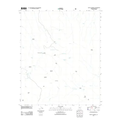
2011 Map of Mount Turnbull
USGS Topo · Published 2011About this map
Mount Turnbull dominates the high-elevation landscape of Graham County in this early 21st-century topographic study. The area is defined by its network of remote water sources and high-desert terrain, where cattle ranching centers on locations such as House Ranch and Weaver Ranch. A rugged topography of peaks and canyons, including Quartzite Mountain, Limestone Mountain, and Granite Peak, dictates the movement of both water and travel through the region.
Find a feature on this map
44 named features on this map. Tap any name to fly to it.
Don’t see what you’re looking for? This feature index may not catch every label — zoom into the map to look around manually.
Map Details
Editions of this 2011 Mount Turnbull Map
This is the sole edition of this map. No revisions or reprints were ever made.
Other maps of this area

1938 · Klondyke
USGS Topo · 1:48,000

1943 · Klondyke
USGS Topo · 1:62,500

1944 · Jackson Mtn.
USGS Topo · 1:62,500

1946 · Jackson Mtn.
USGS Topo · 1:62,500

1954 · Mesa
USGS Topo · 1:250,000

1956 · Tucson
USGS Topo · 1:250,000

1957 · Mesa
USGS Topo · 1:250,000

1958 · Mesa
USGS Topo · 1:250,000

1958 · Tucson
USGS Topo · 1:250,000

1959 · Tucson
USGS Topo · 1:250,000