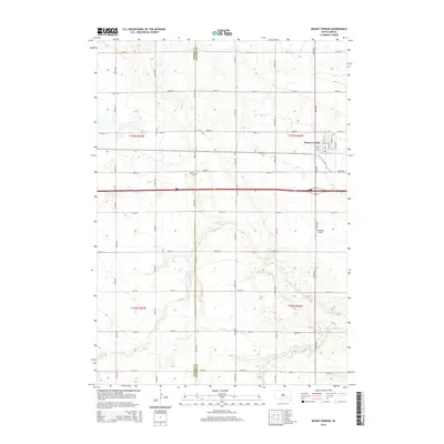
2015 Map of Mount Vernon
USGS Topo · Published 2015About this map
Mount Vernon serves as the primary hub of this eastern South Dakota landscape, situated along the border of Aurora and Davison Counties. The town is organized around a grid of streets including Tibbetts St, Haynes St, and Lindman St, reflecting its character as a local agricultural and transportation center. The surrounding rural townships, defined by the Public Land Survey System as t103n r63w, t103n r62w, t102n r63w, and t102n r62w, show a transition from settled town blocks to expansive fields dissected by a regular intervals of section-line roads.
Find a feature on this map
31 named features on this map. Tap any name to fly to it.
Don’t see what you’re looking for? This feature index may not catch every label — zoom into the map to look around manually.
Map Details
Editions of this 2015 Mount Vernon Map
This is the sole edition of this map. No revisions or reprints were ever made.
Other maps of this area

1899 · Mitchell
USGS Topo · 1:125,000

1955 · Mitchell
USGS Topo · 1:250,000

1959 · Mitchell
USGS Topo · 1:250,000
1979 · Letcher SW
USGS Topo · 1:24,000

1979 · Storla SW
USGS Topo · 1:24,000

1979 · Storla
USGS Topo · 1:24,000

1980 · Stickney
USGS Topo · 1:24,000

1980 · Old Stickney Lake
USGS Topo · 1:24,000
1980 · Mitchell SW
USGS Topo · 1:24,000

1980 · Mount Vernon
USGS Topo · 1:24,000