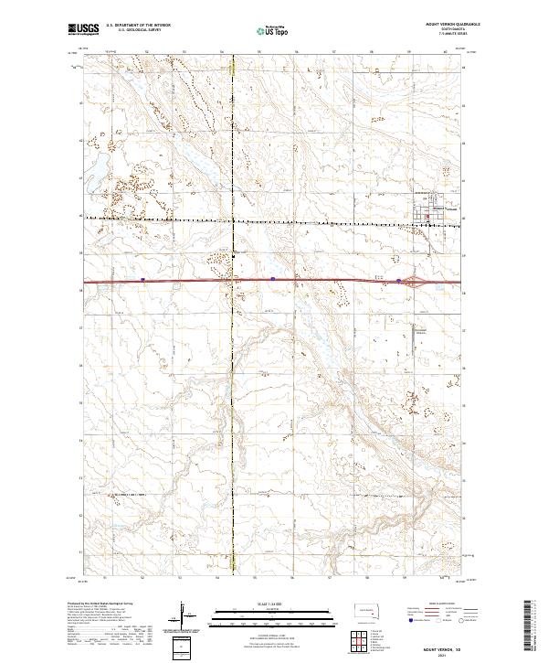
2021 Map of Mount Vernon
USGS Topo · Published 2021About this map
Mount Vernon stands at the intersection of a grid-style township layout and the winding path of Enemy Cr, which meanders through the southern half of the landscape. This agricultural area of South Dakota is defined by its precise road network, including Co Rd 34 and the major passage of Interstate 90. Local history is anchored by the Quaker Cem near the center of the sheet and the Aurora Co Davison Co boundary line that splits the territory. The presence of the Nicolaisen Airport and the street-level details of Mount Vernon, such as N Lindman and S Haynes St, provide a clear picture of the community infrastructure and land division in this part of the Great Plains.
Find a feature on this map
34 named features on this map. Tap any name to fly to it.
Don’t see what you’re looking for? This feature index may not catch every label — zoom into the map to look around manually.
Map Details
Editions of this 2021 Mount Vernon Map
This is the sole edition of this map. No revisions or reprints were ever made.
Other maps of this area

1899 · Mitchell
USGS Topo · 1:125,000

1955 · Mitchell
USGS Topo · 1:250,000

1959 · Mitchell
USGS Topo · 1:250,000
1979 · Letcher SW
USGS Topo · 1:24,000

1979 · Storla SW
USGS Topo · 1:24,000

1979 · Storla
USGS Topo · 1:24,000

1980 · Stickney
USGS Topo · 1:24,000

1980 · Old Stickney Lake
USGS Topo · 1:24,000
1980 · Mitchell SW
USGS Topo · 1:24,000

1980 · Mount Vernon
USGS Topo · 1:24,000