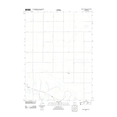
2011 Map of Mount Vernon
USGS Topo · Published 2011About this map
Mount Vernon sits within a landscape defined by the geometric grid of county roads and the wandering course of high-plains water in Cheyenne County. In the southern portion of the quadrangle, Lodgepole Creek meanders eastward, joined by Cow Creek as they traverse the prairie. This 2011 survey documents a highly organized agricultural region where named routes like Road 151, Road 155, and Road 161 form precise mile-wide sections typical of the Great Plains. The convergence of Peterson Blvd and local roads near the creek corridors indicates the primary areas of transit and settlement activity, contrasting with the expansive, open sections to the north. These drainage patterns and road placements provide an essential framework for understanding the land use and hydrology of the Nebraska panhandle during the early 21st century.
Find a feature on this map
16 named features on this map. Tap any name to fly to it.
Don’t see what you’re looking for? This feature index may not catch every label — zoom into the map to look around manually.
Map Details
Editions of this 2011 Mount Vernon Map
This is the sole edition of this map. No revisions or reprints were ever made.
Other maps of this area

1899 · Sidney
USGS Topo · 1:125,000

1900 · Chappell
USGS Topo · 1:125,000

1954 · Scottsbluff
USGS Topo · 1:250,000

1958 · Scottsbluff
USGS Topo · 1:250,000

1961 · Chappell
USGS Topo · 1:24,000

1971 · Oshkosh SW
USGS Topo · 1:24,000

1971 · Chappell NW
USGS Topo · 1:24,000

1972 · Lodgepole
USGS Topo · 1:24,000

1972 · Lisco SW
USGS Topo · 1:24,000
1972 · Lodgepole SE
USGS Topo · 1:24,000