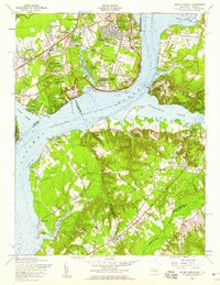
1956 Map of Mount Vernon
USGS Topo · Published 1959About this map
Mount Vernon and its storied surroundings are captured here at a mid-century moment of transition, as the Fairfax and Prince George's borderlands across the Potomac River began to witness suburban expansion. On the Virginia side, the historic landscape is dotted with residential developments like Hybla Valley, Woodley Hills, and Stratford on the Potomac, while maintaining landmarks like Hosley Memorial Chapel and the Snowden Cem.
Find a feature on this map
74 named features on this map. Tap any name to fly to it.
Don’t see what you’re looking for? This feature index may not catch every label — zoom into the map to look around manually.
Map Details
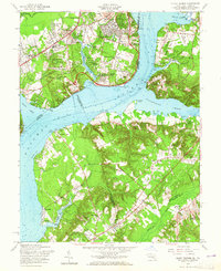
Editions of this 1956 Mount Vernon Map
2 editions found
Other maps of this area

1890 · Mt. Vernon
USGS Topo · 1:125,000

1891 · Mt. Vernon
USGS Topo · 1:125,000

1892 · Brandywine
USGS Topo · 1:62,500

1894 · Mt. Vernon
USGS Topo · 1:125,000

1895 · Brandywine
USGS Topo · 1:62,500

1897 · Mt. Vernon
USGS Topo · 1:125,000

1899 · Patuxent
USGS Topo · 1:125,000

1900 · Washington
USGS Topo · 1:62,500

1906 · Patuxent
USGS Topo · 1:125,000

1911 · Brandywine
USGS Topo · 1:62,500