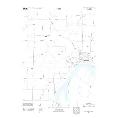
2013 Map of Mount Vernon
USGS Topo · Published 2013About this map
The Ohio River frontage at Mount Vernon anchors this corner of Posey County, where the river's bend defines the southern landscape. The town serves as a regional hub with a dense street grid that transitions into a network of rural roads such as Winkler Ferry Rd and Mackey Ferry Rd, hinting at the area's river-dependent history. Inland, the map reveals a series of small, dispersed communities including Upton, Erwin, and Farmersville, alongside evocative local place names like Dead Mans Crossing. The topography is marked by low-lying water features such as Big Cr Slough and Cypress Slough, while Brewery Hill stands out as a rare named rise. Agriculture and light aviation meet at the Parrish Airport, situated near Indian Cr north of the main settlement. This layout shows a classic Midwestern river town balance between industrial-scale water transport and a quiet, farm-based interior.
Find a feature on this map
135 named features on this map. Tap any name to fly to it.
Don’t see what you’re looking for? This feature index may not catch every label — zoom into the map to look around manually.
Map Details
Editions of this 2013 Mount Vernon Map
This is the sole edition of this map. No revisions or reprints were ever made.
Other maps of this area

1903 · New Harmony
USGS Topo · 1:62,500

1903 · Patoka
USGS Topo · 1:125,000

1905 · New Haven
USGS Topo · 1:62,500

1906 · New Haven
USGS Topo · 1:62,500

1917 · Uniontown
USGS Topo · 1:62,500

1938 · New Harmony
USGS Topo · 1:62,500

1940 · Carmi
USGS Topo · 1:62,500

1943 · Carmi
USGS Topo · 1:62,500

1949 · Paducah
USGS Topo · 1:250,000

1949 · New Haven
USGS Topo · 1:62,500