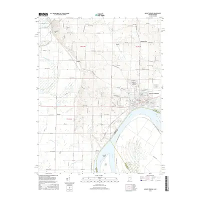
2016 Map of Mount Vernon
USGS Topo · Published 2016About this map
The Ohio River forms the southern boundary of this Posey County landscape, winding past Slim Island and Towhead Island near the settlement of Hovey. The city of Mount Vernon sits along the riverbank, serving as a hub for the region's transport and agriculture. Further inland, the terrain is defined by a dense network of country roads and small communities like Farmersville, Erwin, and Upton. Local family history is well-preserved through numerous burial sites across the township, including Saint Matthews Cem, Alldredge Cem, and Belle Fontaine Cem. To the north and west, drainage systems such as Whipple Ditch and Big Creek Slough navigate the low-lying areas near Prairie. The presence of Brewery Hill and Parrish Airport highlights the varied land use, from elevated landmarks to small-scale aviation infrastructure, all set against the backdrop of the Indiana-Kentucky border.
Find a feature on this map
140 named features on this map. Tap any name to fly to it.
Don’t see what you’re looking for? This feature index may not catch every label — zoom into the map to look around manually.
Map Details
Editions of this 2016 Mount Vernon Map
This is the sole edition of this map. No revisions or reprints were ever made.
Other maps of this area

1903 · New Harmony
USGS Topo · 1:62,500

1903 · Patoka
USGS Topo · 1:125,000

1905 · New Haven
USGS Topo · 1:62,500

1906 · New Haven
USGS Topo · 1:62,500

1917 · Uniontown
USGS Topo · 1:62,500

1938 · New Harmony
USGS Topo · 1:62,500

1940 · Carmi
USGS Topo · 1:62,500

1943 · Carmi
USGS Topo · 1:62,500

1949 · Paducah
USGS Topo · 1:250,000

1949 · New Haven
USGS Topo · 1:62,500