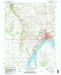
1981 Map of Mount Vernon
USGS Topo · Published 1981About this map
Mount Vernon sits as the focal point along the northern bank of the Ohio River in this 1981 survey, where the river's path defines the border between Posey County and Kentucky. The landscape reflects a diverse economy ranging from the dense industrial presence of Black Field and numerous Oil Wells to the fertile stretches of Prairie. The Louisville and Nashville railroad serves as a primary transport artery, cutting northwest through small communities like Upton and Grafton. Genealogists will find a high density of burial grounds, including Belle Fontaine Cem, St Matthews Cem, and Alldredge Cem, alongside country landmarks like Bethel Ch and the curious Dead Mans Crossing. The map captures the river's dynamic geography with features such as Slim Island and the Mount Vernon Towhead, providing a detailed look at the interface between the river's navigation channels and the agricultural and industrial infrastructure of the shoreline.
Find a feature on this map
50 named features on this map. Tap any name to fly to it.
Don’t see what you’re looking for? This feature index may not catch every label — zoom into the map to look around manually.
Map Details
Editions of this 1981 Mount Vernon Map
This is the sole edition of this map. No revisions or reprints were ever made.
Other maps of this area

1903 · New Harmony
USGS Topo · 1:62,500

1903 · Patoka
USGS Topo · 1:125,000

1905 · New Haven
USGS Topo · 1:62,500

1906 · New Haven
USGS Topo · 1:62,500

1917 · Uniontown
USGS Topo · 1:62,500

1938 · New Harmony
USGS Topo · 1:62,500

1940 · Carmi
USGS Topo · 1:62,500

1943 · Carmi
USGS Topo · 1:62,500

1949 · Paducah
USGS Topo · 1:250,000

1949 · New Haven
USGS Topo · 1:62,500