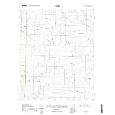
2020 Map of Mount Vernon
USGS Topo · Published 2020About this map
Mount Vernon and the settlement of Romance anchor this 2020 USGS survey of the central Arkansas landscape, where the border of Faulkner and White Counties divides a terrain of ridges and valleys. The area is defined by its dramatic relief, including the heights of Black Jack Mtn and the long expanse of Cadron Ridge in the south. These topographic features influence the winding paths of local thoroughfares like Blackjack Mountain Rd and Bull Mountain Rd.
Find a feature on this map
90 named features on this map. Tap any name to fly to it.
Don’t see what you’re looking for? This feature index may not catch every label — zoom into the map to look around manually.
Map Details
Editions of this 2020 Mount Vernon Map
This is the sole edition of this map. No revisions or reprints were ever made.
Other maps of this area

1953 · Memphis
USGS Topo · 1:250,000

1956 · Memphis
USGS Topo · 1:250,000

1956 · Russellville
USGS Topo · 1:250,000

1963 · Rose Bud
USGS Topo · 1:24,000

1963 · Floyd
USGS Topo · 1:24,000

1963 · Enola
USGS Topo · 1:24,000

1963 · Mount Vernon
USGS Topo · 1:24,000

1963 · Sidon
USGS Topo · 1:24,000
1963 · Beebe
USGS Topo · 1:24,000
1963 · Mountain Springs
USGS Topo · 1:24,000