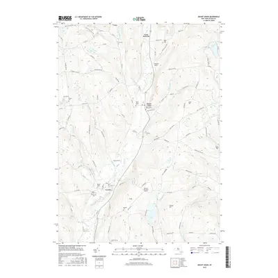
2016 Map of Mount Vision
USGS Topo · Published 2016About this map
Otego Creek and its various branches, including the West Branch, carve a significant valley through this central New York landscape. The settlement of Mount Vision serves as a central point, supported by nearby South Hartwick and Pleasant Valley. A high concentration of burial sites, such as Laurens Village Cem, Maple Grove Cem, and Elm Row Cem, provides a detailed record of the families who settled this agricultural region. The southern portion of the map is defined by the village of Laurens and the Oneonta Municipal Airport, situated near the confluence of Pool Brook and Otego Creek. To the east, the terrain rises toward Lane Hill and Gifford Hill, while the west features the waters of Gilbert Lake and Lake Brook. This survey illustrates the modern layout of rural Otsego County, where historic cemetery names and small hamlets like Lena persist alongside contemporary infrastructure.
Find a feature on this map
102 named features on this map. Tap any name to fly to it.
Don’t see what you’re looking for? This feature index may not catch every label — zoom into the map to look around manually.
Map Details
Editions of this 2016 Mount Vision Map
This is the sole edition of this map. No revisions or reprints were ever made.
Other maps of this area

1907 · Cooperstown
USGS Topo · 1:62,500

1909 · Cooperstown
USGS Topo · 1:62,500

1909 · Delhi
USGS Topo · 1:62,500

1910 · Hartwick
USGS Topo · 1:62,500

1911 · Delhi
USGS Topo · 1:62,500

1912 · Hartwick
USGS Topo · 1:62,500

1915 · Oneonta
USGS Topo · 1:62,500

1918 · Oneonta
USGS Topo · 1:62,500

1943 · Mt Vision
USGS Topo · 1:24,000

1943 · Milford
USGS Topo · 1:24,000