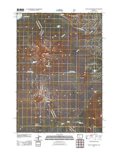
2011 Map of Mount Washington
USGS Topo · Published 2011About this map
The Dee Wright Observatory stands as a prominent landmark on this high-altitude landscape, situated along the crossing of McKenzie Pass. This 2011 survey documents a region defined by its volcanic geology and historical transit corridors, most notably the Old Santiam Wagon Rd winding through the northern terrain. The map captures a high-elevation environment where cinder cones and peaks like Mount Washington, Little Belknap, and Dugout Butte rise above a series of mountain water bodies. Pockets of activity are concentrated at the Seventh Day Adventist Organization Camp near Big Lake, while smaller features like Washington Ponds and Hortense Lake are dispersed across the wilderness. The drainage patterns of Cache Creek and Dry Creek emphasize the complex hydrology of this Oregon Cascades summit area.
Find a feature on this map
18 named features on this map. Tap any name to fly to it.
Don’t see what you’re looking for? This feature index may not catch every label — zoom into the map to look around manually.
Map Details
Editions of this 2011 Mount Washington Map
This is the sole edition of this map. No revisions or reprints were ever made.
Other maps of this area

1929 · Three Sisters
USGS Topo · 1:125,000

1932 · Three Sisters
USGS Topo · 1:125,000

1955 · Bend
USGS Topo · 1:250,000

1957 · Bend
USGS Topo · 1:250,000

1958 · Bend
USGS Topo · 1:250,000

1959 · Broken Top
USGS Topo · 1:62,500
1959 · Three Sisters
USGS Topo · 1:62,500

1959 · Three Fingered Jack
USGS Topo · 1:62,500

1959 · Sisters
USGS Topo · 1:62,500
1980 · Bend
USGS Topo · 1:100,000