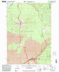
1997 Map of Mount Washington
USGS Topo · Published 2001About this map
The Mount Washington summit and the expansive fields of Lava define this high-country intersection of the Deschutes National Forest and Willamette National Forest. This late-1990s revision details a landscape shaped by both geological time and early pioneer transport, most notably the historic Santiam Wagon Road and the Cache Creek Toll Station.
Find a feature on this map
33 named features on this map. Tap any name to fly to it.
Don’t see what you’re looking for? This feature index may not catch every label — zoom into the map to look around manually.
Map Details
Editions of this 1997 Mount Washington Map
This is the sole edition of this map. No revisions or reprints were ever made.
Other maps of this area

1929 · Three Sisters
USGS Topo · 1:125,000

1932 · Three Sisters
USGS Topo · 1:125,000

1955 · Bend
USGS Topo · 1:250,000

1957 · Bend
USGS Topo · 1:250,000

1958 · Bend
USGS Topo · 1:250,000

1959 · Broken Top
USGS Topo · 1:62,500
1959 · Three Sisters
USGS Topo · 1:62,500

1959 · Three Fingered Jack
USGS Topo · 1:62,500

1959 · Sisters
USGS Topo · 1:62,500
1980 · Bend
USGS Topo · 1:100,000