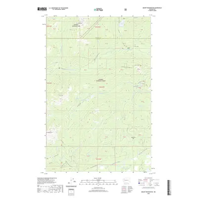
2020 Map of Mount Washington
USGS Topo · Published 2020About this map
Mt Washington and The Brothers define the high elevations of this wilderness landscape, situated at the border of Jefferson Co and Mason Co. The map reveals a rugged backcountry network of trails and summits within Olympic National Park and Olympic National Forest. Waterways like the Hamma Hamma River and Washington Cr carve through the steep terrain, feeding into prominent water bodies such as Lena Lake and Jefferson Lake. The presence of established routes like the Mt Ellinor Trailhead and the Jorsted Creek & Lk Cushman trail suggests a landscape primary used for recreation and resource management. Smaller features like the Hamma Hamma Beaver Pond and Lilliwaup Swamp indicate diverse mountain ecosystems tucked between the high ridges of Jefferson Ridge and Mt Ellinor.
Find a feature on this map
64 named features on this map. Tap any name to fly to it.
Don’t see what you’re looking for? This feature index may not catch every label — zoom into the map to look around manually.
Map Details
Editions of this 2020 Mount Washington Map
This is the sole edition of this map. No revisions or reprints were ever made.
Other maps of this area

1938 · Mt Constance
USGS Topo · 1:125,000

1943 · Potlatch
USGS Topo · 1:62,500

1947 · The Brothers
USGS Topo · 1:62,500

1947 · Mt. Steel
USGS Topo · 1:62,500

1950 · The Brothers
USGS Topo · 1:62,500

1950 · Mt. Steel
USGS Topo · 1:62,500

1952 · Potlatch
USGS Topo · 1:62,500

1953 · Mt Tebo
USGS Topo · 1:62,500

1958 · Seattle
USGS Topo · 1:250,000

1962 · Seattle
USGS Topo · 1:250,000