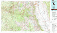
1978 Map of Mount Whitney
USGS Topo · Published 1992About this map
Mt Whitney stands as the dramatic centerpiece of this high-elevation landscape, where the granite crest of the Sierra Nevada meets the arid Owens Valley. In the late 1970s, the valley floor remained a corridor of settlement and transit, defined by the path of US Highway 395 and the waters of the Owens River. To the east, the Inyo Mountains harbor industrial history at the Black Rock Mine and Reward Mine, while the western slopes fall away into the deep drainage of the Kern River. This survey captures a complex intersection of land management, bordering the Sequoia National Park, Kings Canyon National Park, and the John Muir Wilderness. Notable cultural landmarks include the Fort Independence Indian Reservation near Independence and the high-altitude jumping-off point at Whitney Portal.
Find a feature on this map
126 named features on this map. Tap any name to fly to it.
Don’t see what you’re looking for? This feature index may not catch every label — zoom into the map to look around manually.
Map Details
Editions of this 1978 Mount Whitney Map
This is the sole edition of this map. No revisions or reprints were ever made.
Other maps of this area

1903 · Tehipite
USGS Topo · 1:125,000

1904 · Kaiser
USGS Topo · 1:125,000

1904 · Kaweah
USGS Topo · 1:125,000

1905 · Tehipite
USGS Topo · 1:125,000

1905 · Olancha
USGS Topo · 1:125,000

1907 · Olancha
USGS Topo · 1:125,000

1907 · Mt. Whitney
USGS Topo · 1:125,000

1908 · Lida
USGS Topo · 1:250,000

1908 · Ballarat
USGS Topo · 1:250,000

1909 · Kaweah
USGS Topo · 1:125,000