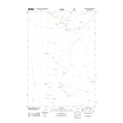
2011 Map of Mount Wood
USGS Topo · Published 2011About this map
Benbow Mine stands as a primary industrial landmark in this high-elevation corner of the Granite Range, where the extraction of minerals shaped the local geography. The map reveals a complex system of drainage and alpine water bodies, including Chrome Lake and the high-altitude West Fishtail Creek Lakes. To the west, the massive Stillwater Plateau dominates the landscape, dropping off toward the drainage of Woodbine Creek. The terrain is punctuated by significant peaks like Mount Wood and Mount Hague, while curiosities like the plateau feature known as The Golf Course provide unique points of interest for those studying the high country of Stillwater County. This survey provides a precise look at the hydrology of the area, tracing West Fishtail Creek and its various tributaries as they carve through the mountain passes.
Find a feature on this map
20 named features on this map. Tap any name to fly to it.
Don’t see what you’re looking for? This feature index may not catch every label — zoom into the map to look around manually.
Map Details
Editions of this 2011 Mount Wood Map
This is the sole edition of this map. No revisions or reprints were ever made.
Other maps of this area

1898 · Granite Mountain District
USGS Topo · 1:125,000

1932 · Nye No 1
USGS Topo · 1:48,000

1932 · Nye No 2
USGS Topo · 1:48,000

1939 · Mt Wood
USGS Topo · 1:62,500

1941 · Mt. Wood
USGS Topo · 1:62,500

1954 · Billings
USGS Topo · 1:250,000
1956 · Emerald Lake
USGS Topo · 1:24,000

1956 · Alpine
USGS Topo · 1:62,500
1956 · Beehive
USGS Topo · 1:24,000

1956 · Cooke City
USGS Topo · 1:62,500