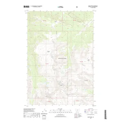
2020 Map of Mount Wood
USGS Topo · Published 2020About this map
Mt Wood and the towering Granite Range dominate this high-elevation wilderness within Custer National Forest. The landscape is defined by vast alpine expanses like the Stillwater Plateau and Fishtail Plateau, which separate deep drainages fed by numerous high mountain basins. Glacial activity is evident in the cluster of remote alpine water bodies, including West Fishtail Cr Lakes, Lake Wilderness, and Jawbone Lake at the southern edge of the survey.
Find a feature on this map
46 named features on this map. Tap any name to fly to it.
Don’t see what you’re looking for? This feature index may not catch every label — zoom into the map to look around manually.
Map Details
Editions of this 2020 Mount Wood Map
This is the sole edition of this map. No revisions or reprints were ever made.
Other maps of this area

1898 · Granite Mountain District
USGS Topo · 1:125,000

1932 · Nye No 1
USGS Topo · 1:48,000

1932 · Nye No 2
USGS Topo · 1:48,000

1939 · Mt Wood
USGS Topo · 1:62,500

1941 · Mt. Wood
USGS Topo · 1:62,500

1954 · Billings
USGS Topo · 1:250,000
1956 · Emerald Lake
USGS Topo · 1:24,000

1956 · Alpine
USGS Topo · 1:62,500
1956 · Beehive
USGS Topo · 1:24,000

1956 · Cooke City
USGS Topo · 1:62,500