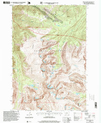
1996 Map of Mount Wood
USGS Topo · Published 1999About this map
The high alpine terrain of Stillwater County is defined here by the massive peaks and glacial basins of the Absaroka-Beartooth Wilderness. At the heart of the sheet, Mount Wood and Mount Hague dominate the skyline, overlooking a series of high-altitude lakes including Woodbine Lake, Lake Wilderness, and Chrome Lake. The presence of a Mine Shaft north of the wilderness boundary near Golf Course Creek points to the area's history of mineral exploration, while the expansive Stillwater Plateau provides a level break in the otherwise vertical landscape.
Find a feature on this map
25 named features on this map. Tap any name to fly to it.
Don’t see what you’re looking for? This feature index may not catch every label — zoom into the map to look around manually.
Map Details
Editions of this 1996 Mount Wood Map
This is the sole edition of this map. No revisions or reprints were ever made.
Other maps of this area

1898 · Granite Mountain District
USGS Topo · 1:125,000

1932 · Nye No 1
USGS Topo · 1:48,000

1932 · Nye No 2
USGS Topo · 1:48,000

1939 · Mt Wood
USGS Topo · 1:62,500

1941 · Mt. Wood
USGS Topo · 1:62,500

1954 · Billings
USGS Topo · 1:250,000
1956 · Emerald Lake
USGS Topo · 1:24,000

1956 · Alpine
USGS Topo · 1:62,500
1956 · Beehive
USGS Topo · 1:24,000

1956 · Cooke City
USGS Topo · 1:62,500