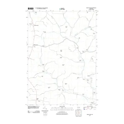
2010 Map of Mount Zion
USGS Topo · Published 2010About this map
The settlement of Mount Zion sits at the southern reach of this Crawford County landscape, where the ridge and valley topography of southwestern Wisconsin is clearly defined by named features like Lightfoot Ridge and Sleepy Hollow. Small agricultural hubs and historic hamlets dot the region, including Rolling Ground, Tavera, and Jimtown, connected by a network of county highways and winding local roads. The map reveals a land deeply tied to family farming, evidenced by numerous named agricultural operations such as the Ellsworth Home Stock Farm and Sugar Tree Farm.
Find a feature on this map
84 named features on this map. Tap any name to fly to it.
Don’t see what you’re looking for? This feature index may not catch every label — zoom into the map to look around manually.
Map Details
Editions of this 2010 Mount Zion Map
This is the sole edition of this map. No revisions or reprints were ever made.
Other maps of this area

1924 · Gays Mills
USGS Topo · 1:62,500

1926 · Gays Mills
USGS Topo · 1:62,500

1926 · Wauzeka
USGS Topo · 1:62,500

1933 · Boaz
USGS Topo · 1:62,500

1933 · Boscobel
USGS Topo · 1:62,500

1958 · La Crosse
USGS Topo · 1:250,000

1961 · La Crosse
USGS Topo · 1:250,000

1965 · La Crosse
USGS Topo · 1:250,000
1966 · Gays Mills
USGS Topo · 1:62,500

1966 · Boaz
USGS Topo · 1:62,500