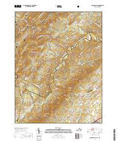
2019 Map of Mountain Falls
USGS Topo · Published 2019About this map
Great North Mountain and Little North Mountain define the topography of this region along the border of Frederick and Shenandoah counties. In the northwest, the boundary between Virginia and West Virginia crosses the slopes of Spring Mtn and Short Mtn. A series of hollows and ridges, including Polebridge Hollow and Tarkiln Ridge, separate the high peaks from the valleys below. Central to the map is the settlement of Gravel Springs, where the Gravel Springs Cem is located near the headwaters of Gravel Springs Run. To the south, the community of Zepp lies near the intersection of several local roads. This area is characterized by numerous small cemeteries, such as Saint Stephens Cem and Laurel Hill Cem, often situated along drainage ways like Mulberry Run or Tumbling Run. Much of the western terrain is protected as part of the George Washington National Forest.
Find a feature on this map
56 named features on this map. Tap any name to fly to it.
Don’t see what you’re looking for? This feature index may not catch every label — zoom into the map to look around manually.
Map Details
Editions of this 2019 Mountain Falls Map
This is the sole edition of this map. No revisions or reprints were ever made.
Other maps of this area

1891 · Romney
USGS Topo · 1:125,000

1892 · Woodstock
USGS Topo · 1:125,000

1893 · Luray
USGS Topo · 1:125,000

1894 · Winchester
USGS Topo · 1:125,000

1905 · Luray
USGS Topo · 1:125,000

1922 · Wardensville
USGS Topo · 1:62,500

1923 · Middletown
USGS Topo · 1:62,500

1923 · Edinburg
USGS Topo · 1:62,500

1924 · Wardensville
USGS Topo · 1:62,500

1937 · Middletown
USGS Topo · 1:48,000