
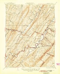
1924 Map of Wardensville
USGS Topo · Published 1924About this map
Wardensville sits at the heart of this 1920s Appalachian landscape, where the Cacapon River winds through narrow valleys defined by Shenandoah Mountain and Baker Mountain. The town serves as a hub for a network of rural schoolhouses and churches, including the Heishman School and Crest Hill Church, reflecting a mountain society built around local timber and small-scale agriculture. The presence of a Furnace near Waites Run points to the area's iron-making heritage, while the Western Maryland railroad line traces the base of the ridges. Much of the southern terrain is preserved within the George Washington National Forest, where labels like Hanging Rock and Three High Heads denote the prominent peaks. Small settlements such as Baker, Rio, and Kirby are scattered across the Hampshire and Hardy County lines, linked by early routes like the Winchester and Wardensville road.
Find a feature on this map
85 named features on this map. Tap any name to fly to it.
Don’t see what you’re looking for? This feature index may not catch every label — zoom into the map to look around manually.
Map Details
Editions of this 1924 Wardensville Map
2 editions found
Other maps of this area

1891 · Romney
USGS Topo · 1:125,000

1892 · Woodstock
USGS Topo · 1:125,000

1893 · Luray
USGS Topo · 1:125,000

1894 · Winchester
USGS Topo · 1:125,000

1905 · Luray
USGS Topo · 1:125,000

1916 · Capon Bridge
USGS Topo · 1:62,500

1920 · Moorefield
USGS Topo · 1:62,500

1920 · Keyser
USGS Topo · 1:62,500

1921 · Orkney Springs
USGS Topo · 1:48,000

1921 · Keyser
USGS Topo · 1:48,000