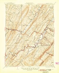
1924 Map of Wardensville
USGS Topo · Published 1944About this map
Wardensville serves as the focal point of this 1920s topography, situated where the Cacapon River and Waites Run meet against the backdrop of Anderson Ridge. The landscape is defined by the sharp, parallel ridges of the Appalachian Mountains, including Stony Mountain and Baker Mountain, which dictate the paths of early twentieth-century travel. The Winchester and Western rail line threads through the narrow gaps, connecting the isolated settlement at Capon Springs Station to the broader region.
Find a feature on this map
87 named features on this map. Tap any name to fly to it.
Don’t see what you’re looking for? This feature index may not catch every label — zoom into the map to look around manually.
Map Details
Editions of this 1924 Wardensville Map
2 editions found

Other maps of this area

1891 · Romney
USGS Topo · 1:125,000

1892 · Woodstock
USGS Topo · 1:125,000

1893 · Luray
USGS Topo · 1:125,000

1894 · Winchester
USGS Topo · 1:125,000

1905 · Luray
USGS Topo · 1:125,000

1916 · Capon Bridge
USGS Topo · 1:62,500

1920 · Moorefield
USGS Topo · 1:62,500

1920 · Keyser
USGS Topo · 1:62,500

1921 · Orkney Springs
USGS Topo · 1:48,000

1921 · Keyser
USGS Topo · 1:48,000