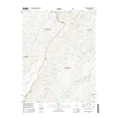
2016 Map of Mountain Grove
USGS Topo · Published 2016About this map
Mountain Grove and Rimel anchor this high-elevation landscape along the border of Virginia and West Virginia, where the Monongahela National Forest and George Washington National Forest meet. The terrain is defined by the sharp ridges of the Allegheny Mountains and Meadow Creek Mtn, with the Jackson River and Back Creek carving deep drainage patterns through the valleys. The map reveals a complex network of forest trails and hollows, many bearing names that suggest 19th-century settlement or land use, such as Schoolhouse Hollow, Ash Cabin Hollow, and Vance Lick Hollow. This 2016 survey provides a clear view of how modern boundaries and forest roads like State Rte 600 follow the natural contours of the gaps and drafts, particularly around Ryder Gap and the passage at McClintic Bridge.
Find a feature on this map
87 named features on this map. Tap any name to fly to it.
Don’t see what you’re looking for? This feature index may not catch every label — zoom into the map to look around manually.
Map Details
Editions of this 2016 Mountain Grove Map
This is the sole edition of this map. No revisions or reprints were ever made.
Other maps of this area

1887 · Lewisburg
USGS Topo · 1:125,000

1891 · Lewisburg
USGS Topo · 1:125,000

1891 · Huntersville
USGS Topo · 1:125,000

1894 · Huntersville
USGS Topo · 1:125,000

1894 · Natural Bridge
USGS Topo · 1:125,000

1901 · Monterey
USGS Topo · 1:125,000

1921 · Callaghan
USGS Topo · 1:48,000

1923 · Marlinton
USGS Topo · 1:48,000

1923 · Warm Springs
USGS Topo · 1:48,000

1923 · Callaghan
USGS Topo · 1:62,500