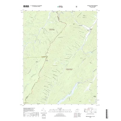
2019 Map of Mountain Grove
USGS Topo · Published 2019About this map
Mountain Grove and Mooretown anchor the eastern slopes of the Allegheny Mountains in this modern topographic study, where the borders of West Virginia and Virginia meet. The landscape is defined by the high ridges of the Monongahela National Forest and George Washington National Forest, bisected by the water systems of the Jackson River and Back Creek. Local history is preserved in sites like the Mountain Grove Cem and McClintic Bridge, while the area's recreational geography is mapped through an extensive network of fire roads and wilderness paths including the Allegheny Mountain Trail # 611 and Two Lick Trail # 456.
Find a feature on this map
86 named features on this map. Tap any name to fly to it.
Don’t see what you’re looking for? This feature index may not catch every label — zoom into the map to look around manually.
Map Details
Editions of this 2019 Mountain Grove Map
This is the sole edition of this map. No revisions or reprints were ever made.
Other maps of this area

1887 · Lewisburg
USGS Topo · 1:125,000

1891 · Lewisburg
USGS Topo · 1:125,000

1891 · Huntersville
USGS Topo · 1:125,000

1894 · Huntersville
USGS Topo · 1:125,000

1894 · Natural Bridge
USGS Topo · 1:125,000

1901 · Monterey
USGS Topo · 1:125,000

1921 · Callaghan
USGS Topo · 1:48,000

1923 · Marlinton
USGS Topo · 1:48,000

1923 · Warm Springs
USGS Topo · 1:48,000

1923 · Callaghan
USGS Topo · 1:62,500