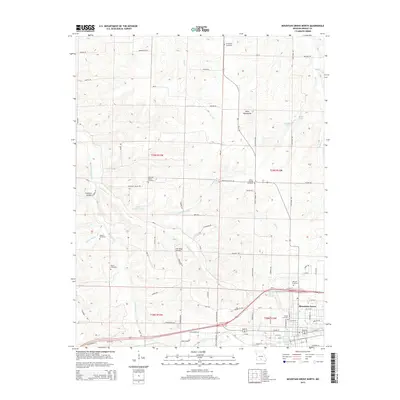
2015 Map of Mountain Grove North
USGS Topo · Published 2015About this map
Mountain Grove serves as the primary hub in this southern Missouri landscape, where the town’s northern reaches meet a network of rural homesteads and agricultural valleys. Numerous family and community burial grounds, such as Hillcrest Cemetery, Mountain Valley Cemetery, and Swede Cemetery, are distributed across the township lines of t29n r13w and t29n r12w, providing significant data points for genealogical research. The terrain is defined by the Dove Mountains and several water systems, including Whetstone Cr and Absher Prong. Notable local infrastructure includes the Oak Ridge Airpark and smaller water bodies like Doris Leascher Lake and Porter Lake. The concentration of cemeteries, from Friendship Cemetery in the north to Helum Cemetery further west, suggests a long-standing pattern of dispersed upland settlement tied to the drainage basins of Dove Cr and Beaver Cr.
Find a feature on this map
88 named features on this map. Tap any name to fly to it.
Don’t see what you’re looking for? This feature index may not catch every label — zoom into the map to look around manually.
Map Details
Editions of this 2015 Mountain Grove North Map
This is the sole edition of this map. No revisions or reprints were ever made.
Other maps of this area

1931 · Manes
USGS Topo · 1:48,000

1941 · Manes
USGS Topo · 1:62,500

1941 · Bado
USGS Topo · 1:62,500

1943 · Manes
USGS Topo · 1:62,500

1943 · Bado
USGS Topo · 1:62,500

1950 · Cabool SW
USGS Topo · 1:24,000

1951 · Norwood
USGS Topo · 1:24,000

1951 · Mountain Grove South
USGS Topo · 1:24,000

1951 · Mountain Grove North
USGS Topo · 1:24,000

1951 · Cabool NW
USGS Topo · 1:24,000