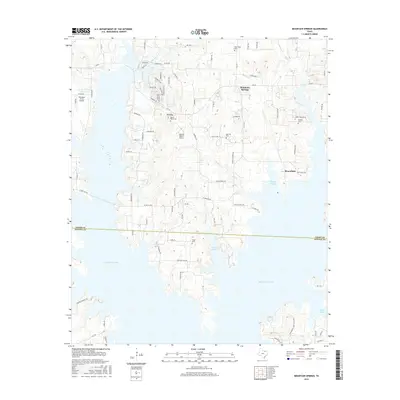
2016 Map of Mountain Springs
USGS Topo · Published 2016About this map
Ray Roberts Lake dominates the western and southern reaches of this landscape, its expansive shoreline defining the modern character of the Cooke and Denton county line. The interior terrain is marked by a network of smaller watercourses like Persimmon Cr and Lick Cr that feed into the larger reservoir. Small settlements and rural hubs such as Mountain Springs and Bloomfield remain centers of local activity, connected by a web of routes including FM 922 and local roads with evocative names like Chisholm Trl and Pioneer Trl. For the local historian, the map preserves the locations of several community landmarks, including New Hope Cem, Oak Hill Cem, and Mount Olive Cem. Regional transportation is supported by private landing strips like Tailwheel Acres Airport, while the established Ray Roberts Lake State Park along the southern banks highlights the area's role in North Texas recreation.
Find a feature on this map
91 named features on this map. Tap any name to fly to it.
Don’t see what you’re looking for? This feature index may not catch every label — zoom into the map to look around manually.
Map Details
Editions of this 2016 Mountain Springs Map
This is the sole edition of this map. No revisions or reprints were ever made.
Other maps of this area

1901 · Denison
USGS Topo · 1:125,000

1902 · Gainesville
USGS Topo · 1:125,000

1943 · Gainesville
USGS Topo · 1:125,000

1954 · Sherman
USGS Topo · 1:250,000

1958 · Whitesboro
USGS Topo · 1:62,500

1958 · Sherman
USGS Topo · 1:250,000

1960 · Sanger
USGS Topo · 1:24,000

1960 · Green Valley
USGS Topo · 1:24,000

1960 · Aubrey
USGS Topo · 1:24,000

1960 · Gainesville South
USGS Topo · 1:24,000