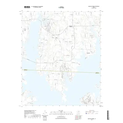
2019 Map of Mountain Springs
USGS Topo · Published 2019About this map
Mountain Springs and Bloomfield anchor this landscape along the border of Cooke and Denton counties, situated north of the waters of Ray Roberts Lake State Park. The map reveals a deeply rooted rural community defined by its family and community burial grounds, including New Hope Cem, Walling Cem, and Bloomfield Cem. The terrain is drained by a network of seasonal watercourses such as Walnut Branch, Lick Creek, and Wolf Cr, which have shaped the settlement patterns of this north Texas region. Small private airfields like Tailwheel Acres Airport and Melody Ranch Airport punctuate the agricultural landscape, while the complex of recreational trails—including the DORBA Trail Green Loop and DORBA Trail Blue Loop—indicates the modern transition of the shoreline area into a significant conservation and outdoor destination.
Find a feature on this map
102 named features on this map. Tap any name to fly to it.
Don’t see what you’re looking for? This feature index may not catch every label — zoom into the map to look around manually.
Map Details
Editions of this 2019 Mountain Springs Map
This is the sole edition of this map. No revisions or reprints were ever made.
Other maps of this area

1901 · Denison
USGS Topo · 1:125,000

1902 · Gainesville
USGS Topo · 1:125,000

1943 · Gainesville
USGS Topo · 1:125,000

1954 · Sherman
USGS Topo · 1:250,000

1958 · Whitesboro
USGS Topo · 1:62,500

1958 · Sherman
USGS Topo · 1:250,000

1960 · Sanger
USGS Topo · 1:24,000

1960 · Green Valley
USGS Topo · 1:24,000

1960 · Aubrey
USGS Topo · 1:24,000

1960 · Gainesville South
USGS Topo · 1:24,000