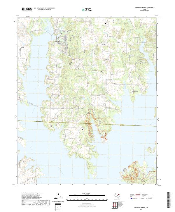
2022 Map of Mountain Springs
USGS Topo · Published 2022About this map
Mountain Springs and its surrounding countryside in Cooke County sit at the edge of significant shoreline development along the Elm Fork Trinity River. The landscape is a mix of small unincorporated settlements and rural homesteads, with the water's edge defining much of the local geography. Several cemeteries, including Mount Olive Cem, Oak Hill Cem, and Bloomfield Jones Cem, are dispersed throughout the region, serving as vital touchstones for family historians tracing roots in north-central Texas. Transport in the area is anchored by FM 922, while local aviation is represented by Tailwheel Acres Airport and Melody Ranch Airport. The southern reaches of the map show the recreational expansion into Ray Roberts Lake State Park, where the terrain drops into Dogwood Canyon near the Denton County line.
Find a feature on this map
101 named features on this map. Tap any name to fly to it.
Don’t see what you’re looking for? This feature index may not catch every label — zoom into the map to look around manually.
Map Details
Editions of this 2022 Mountain Springs Map
This is the sole edition of this map. No revisions or reprints were ever made.
Other maps of this area

1901 · Denison
USGS Topo · 1:125,000

1902 · Gainesville
USGS Topo · 1:125,000

1943 · Gainesville
USGS Topo · 1:125,000

1954 · Sherman
USGS Topo · 1:250,000

1958 · Whitesboro
USGS Topo · 1:62,500

1958 · Sherman
USGS Topo · 1:250,000

1960 · Sanger
USGS Topo · 1:24,000

1960 · Green Valley
USGS Topo · 1:24,000

1960 · Aubrey
USGS Topo · 1:24,000

1960 · Gainesville South
USGS Topo · 1:24,000