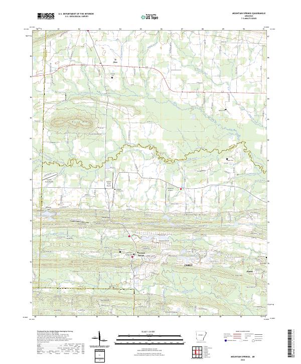
2024 Map of Mountain Springs
USGS Topo · Published 2024About this map
Mountain Springs and the surrounding Arkansas landscape near the intersection of Faulkner, White, and Lonoke counties are defined by a network of bayous and ridges. To the north, the small settlement of El Paso sits near Cadron Ridge, while the southern reaches of the map show the northward expansion of Cabot and Austin. This area is characterized by its transition from the higher elevations of Round Mtn and Ballard Hill toward the drainage basins of Cypress Bayou and Little Cypress Creek.
Find a feature on this map
163 named features on this map. Tap any name to fly to it.
Don’t see what you’re looking for? This feature index may not catch every label — zoom into the map to look around manually.
Map Details
Editions of this 2024 Mountain Springs Map
This is the sole edition of this map. No revisions or reprints were ever made.
Other maps of this area

1891 · Little Rock
USGS Topo · 1:125,000

1893 · Little Rock
USGS Topo · 1:125,000

1940 · Lonoke
USGS Topo · 1:62,500

1941 · Olmstead
USGS Topo · 1:31,680

1941 · Cabot
USGS Topo · 1:31,680

1948 · Helena
USGS Topo · 1:250,000

1949 · Lonoke
USGS Topo · 1:62,500

1950 · Helena
USGS Topo · 1:250,000

1950 · Lonoke
USGS Topo · 1:62,500

1953 · Memphis
USGS Topo · 1:250,000