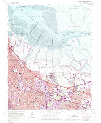
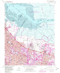
1961 Map of Mountain View
USGS Topo · Published 1975About this map
Naval Air Station Moffett Field and its expansive Naval Reservation dominate the bayfront landscape, marking a period of intense military and technological presence in the South Bay. This mid-century survey reveals the rapid suburbanization of Mountain View, Palo Alto, and Sunnyvale, where new neighborhoods are seen filling the spaces between established orchards and the Southern Pacific tracks. To the north, the industrial character of the shoreline is defined by massive Salt Evaporators and winding tidal channels like Coyote Creek and Alviso Slough.
Find a feature on this map
90 named features on this map. Tap any name to fly to it.
Don’t see what you’re looking for? This feature index may not catch every label — zoom into the map to look around manually.
Map Details
Editions of this 1961 Mountain View Map
5 editions found
Other maps of this area

1889 · San Jose
USGS Topo · 1:62,500

1897 · San Jose
USGS Topo · 1:62,500

1897 · Palo Alto
USGS Topo · 1:62,500

1899 · San Jose
USGS Topo · 1:62,500

1899 · Palo Alto
USGS Topo · 1:62,500

1899 · Haywards
USGS Topo · 1:62,500

1902 · Santa Cruz
USGS Topo · 1:125,000

1906 · Pleasanton
USGS Topo · 1:62,500

1915 · Haywards
USGS Topo · 1:62,500

1941 · Pleasanton
USGS Topo · 1:62,500