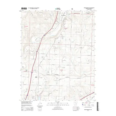
2014 Map of Mountainburg SW
USGS Topo · Published 2014About this map
Alma serves as the southern anchor of this 2014 survey, where the landscape transitions from the developed city and Lake Alma toward the protected woodlands of the Ozark National Forest. The map documents a corridor defined by the winding course of Frog Bayou, which is flanked by the small communities of Dean Springs, Cain, and Graphic. These settlements are marked by deep-rooted family ties, evidenced by numerous burial sites such as the Hatfield Cem, Conley Cem, and the Wynn Graveyard. High points like Winn Mtn and Revis Hill rise above the drainage basins of Little Frog Bayou and Little Mulberry Cr, illustrating the complex hydrology that historically dictated road placement and property lines in Crawford County. The inclusion of smaller locales like Deans Market and Bonita Hollow provides valuable location data for local history researchers.
Find a feature on this map
174 named features on this map. Tap any name to fly to it.
Don’t see what you’re looking for? This feature index may not catch every label — zoom into the map to look around manually.
Map Details
Editions of this 2014 Mountainburg SW Map
This is the sole edition of this map. No revisions or reprints were ever made.
Other maps of this area

1879 · Fort Smith
USGS Topo · 1:62,500

1887 · Van Buren
USGS Topo · 1:62,500

1890 · Fort Smith
USGS Topo · 1:125,000

1898 · Winslow #4
USGS Topo · 1:62,500

1898 · Winslow #3
USGS Topo · 1:62,500

1898 · Winslow
USGS Topo · 1:125,000

1901 · Winslow
USGS Topo · 1:125,000

1906 · Lavaca
USGS Topo · 1:62,500

1943 · Fort Smith
USGS Topo · 1:125,000

1946 · Fort Smith
USGS Topo · 1:250,000