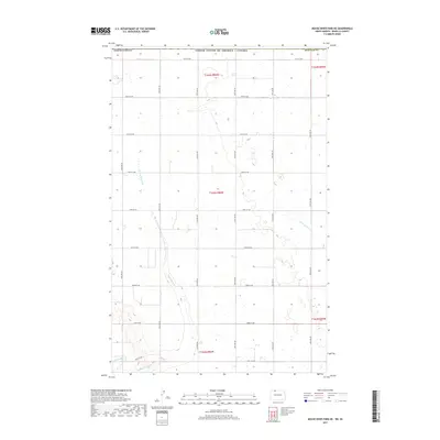
2017 Map of Mouse River Park NE
USGS Topo · Published 2017About this map
Sevenmile Coulee cuts a winding path through the prairie of northwestern North Dakota, leading toward the Souris River in the southwestern corner of this survey. Situated along the international boundary between the United States and Canada, this portion of Renville County is defined by its rectilinear grid of section roads and scattered prairie potholes. The landscape is primarily agricultural, evidenced by the dense network of local routes such as 109th St NW and 52nd Ave NW that serve the outlying farmsteads. The drainage pattern of Little Deep Cr in the east and the larger coulees suggests a terrain shaped by post-glacial runoff, providing a look at the rural infrastructure and land management near the border during the early 21st century.
Find a feature on this map
26 named features on this map. Tap any name to fly to it.
Don’t see what you’re looking for? This feature index may not catch every label — zoom into the map to look around manually.
Map Details
Editions of this 2017 Mouse River Park NE Map
This is the sole edition of this map. No revisions or reprints were ever made.
Other maps of this area

1948 · Mouse River Park NW
USGS Topo · 1:24,000

1949 · Mohall SW
USGS Topo · 1:24,000

1949 · Mouse River Park NW
USGS Topo · 1:24,000

1949 · Sherwood
USGS Topo · 1:24,000

1949 · Mouse River Park NE
USGS Topo · 1:24,000

1949 · Mouse River Park SW
USGS Topo · 1:24,000

1949 · Mouse River Park
USGS Topo · 1:24,000

1950 · Mohall
USGS Topo · 1:62,500
1950 · Mouse River Park
USGS Topo · 1:62,500

1954 · Minot
USGS Topo · 1:250,000