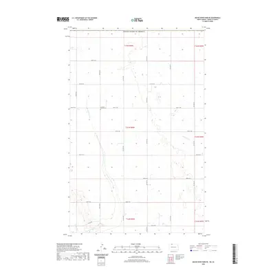
2020 Map of Mouse River Park NE
USGS Topo · Published 2020About this map
Prosperity Township Cem stands as a focal point for genealogy in this corner of Renville County, situated amidst the expansive township and range sections of North Dakota. The landscape is defined by the winding course of Sevenmile Coulee, which carves through the prairie towards the southwest, eventually meeting the Souris River at the very edge of the map. This terrain is characterized by a high density of small prairie wetlands and glacial depressions typical of the region's agricultural heartland. To the east, the drainage of Little Deep Cr marks the divide between sections, while a rigid grid of rural routes like 106th St NW and 50th Ave NW provides the primary infrastructure for the scattered farmsteads that define the area's modern land use.
Find a feature on this map
25 named features on this map. Tap any name to fly to it.
Don’t see what you’re looking for? This feature index may not catch every label — zoom into the map to look around manually.
Map Details
Editions of this 2020 Mouse River Park NE Map
This is the sole edition of this map. No revisions or reprints were ever made.
Other maps of this area

1948 · Mouse River Park NW
USGS Topo · 1:24,000

1949 · Mohall SW
USGS Topo · 1:24,000

1949 · Mouse River Park NW
USGS Topo · 1:24,000

1949 · Sherwood
USGS Topo · 1:24,000

1949 · Mouse River Park NE
USGS Topo · 1:24,000

1949 · Mouse River Park SW
USGS Topo · 1:24,000

1949 · Mouse River Park
USGS Topo · 1:24,000

1950 · Mohall
USGS Topo · 1:62,500
1950 · Mouse River Park
USGS Topo · 1:62,500

1954 · Minot
USGS Topo · 1:250,000