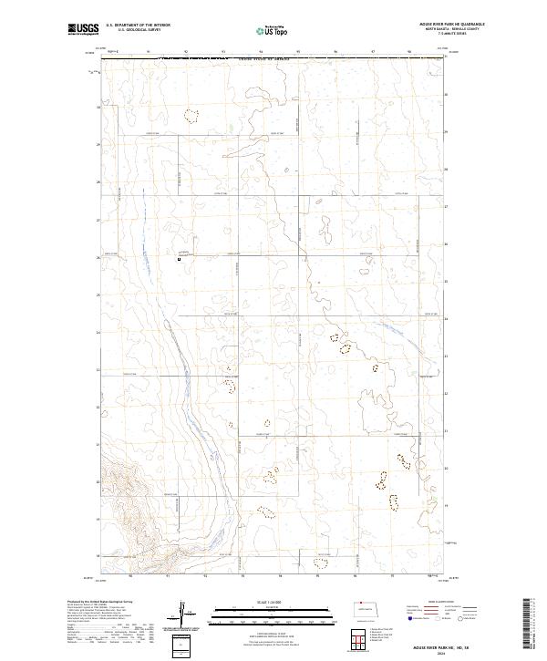
2024 Map of Mouse River Park NE
USGS Topo · Published 2024About this map
Prosperity Township Cem sits at the heart of this rural Renville County landscape, situated near the intersection of 106th St NW and 52nd Ave NW. This area is characterized by a high density of wetlands and depressions typical of the Northern Plains, where seasonal drainage is managed by systems like Sevenmile Coulee and Little Deep Creek. The map reveals a precise section-line road grid that defines the agricultural layout of the region, with the international border with Canada forming the northern boundary of the survey. The terrain reflects the glacial history of North Dakota, where the lack of a primary urban center emphasizes the importance of rural township landmarks and natural drainage patterns in defining local geography.
Find a feature on this map
24 named features on this map. Tap any name to fly to it.
Don’t see what you’re looking for? This feature index may not catch every label — zoom into the map to look around manually.
Map Details
Editions of this 2024 Mouse River Park NE Map
This is the sole edition of this map. No revisions or reprints were ever made.
Other maps of this area

1948 · Mouse River Park NW
USGS Topo · 1:24,000

1949 · Mohall SW
USGS Topo · 1:24,000

1949 · Mouse River Park NW
USGS Topo · 1:24,000

1949 · Sherwood
USGS Topo · 1:24,000

1949 · Mouse River Park NE
USGS Topo · 1:24,000

1949 · Mouse River Park SW
USGS Topo · 1:24,000

1949 · Mouse River Park
USGS Topo · 1:24,000

1950 · Mohall
USGS Topo · 1:62,500
1950 · Mouse River Park
USGS Topo · 1:62,500

1954 · Minot
USGS Topo · 1:250,000