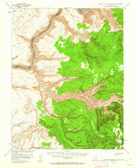
1952 Map of Mouth of Dark Canyon
USGS Topo · Published 1962About this map
The confluence of high-desert mesas and deep river incisions is captured here at a pivotal moment for the Colorado River drainage. While the Colorado River still flows through Cataract Canyon, the encroachment of Lake Powell is noted at its projected 3700-foot elevation, indicating the coming transformation of this canyon landscape. This 1952 field survey shows the terrain prior to the full impact of regional dam projects, preserving the original positions of Dark Canyon Rapids and the winding course of the Dark Canyon drainage.
Find a feature on this map
35 named features on this map. Tap any name to fly to it.
Don’t see what you’re looking for? This feature index may not catch every label — zoom into the map to look around manually.
Map Details
Editions of this 1952 Mouth of Dark Canyon Map
3 editions found
Other maps of this area

1885 · San Rafael
USGS Topo · 1:250,000

1885 · La Sal
USGS Topo · 1:250,000

1886 · Henry Mountains
USGS Topo · 1:250,000

1886 · Abajo
USGS Topo · 1:250,000

1892 · Abajo
USGS Topo · 1:250,000

1892 · Henry Mountains
USGS Topo · 1:250,000

1893 · Abajo
USGS Topo · 1:250,000

1935 · Elk Ridge
USGS Topo · 1:96,000

1940 · Elk Ridge
USGS Topo · 1:125,000

1952 · Mouth of Dark Canyon
USGS Topo · 1:62,500