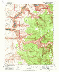
1952 Map of Mouth of Dark Canyon
USGS Topo · Published 1970About this map
Lake Powell and the Colorado River dominate this 1952 topographic study, as corrected in 1969 to reflect the landscape of the Glen Canyon National Recreation Area. The map captures the meeting of massive drainages, where Cataract Canyon transitions into the lake's rising waters. High above the river, the landscape is defined by massive mesas and plateaus like the Dark Canyon Plateau and Dry Mesa, carved by an intricate network of tributary canyons including Gypsum Canyon and the winding Dark Canyon.
Find a feature on this map
41 named features on this map. Tap any name to fly to it.
Don’t see what you’re looking for? This feature index may not catch every label — zoom into the map to look around manually.
Map Details
Editions of this 1952 Mouth of Dark Canyon Map
3 editions found
Other maps of this area

1885 · San Rafael
USGS Topo · 1:250,000

1885 · La Sal
USGS Topo · 1:250,000

1886 · Henry Mountains
USGS Topo · 1:250,000

1886 · Abajo
USGS Topo · 1:250,000

1892 · Abajo
USGS Topo · 1:250,000

1892 · Henry Mountains
USGS Topo · 1:250,000

1893 · Abajo
USGS Topo · 1:250,000

1935 · Elk Ridge
USGS Topo · 1:96,000

1940 · Elk Ridge
USGS Topo · 1:125,000

1952 · Mouth of Dark Canyon
USGS Topo · 1:62,500