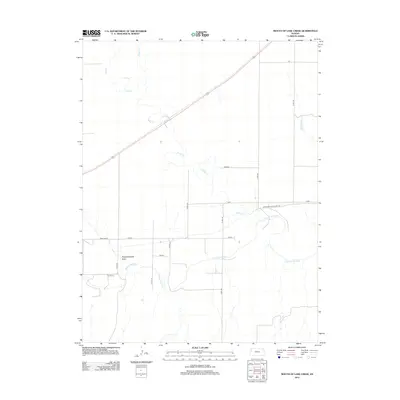
2012 Map of Mouth of Lake Creek
USGS Topo · Published 2012About this map
The Smoky Hill River meanders through this western Kansas landscape, providing the primary drainage for a region characterized by wide open spaces and seasonal watercourses. A significant historical marker on the terrain is the Butterfield Overland Trl, which traces a path across the northeastern portion of the sheet, recalling the era of stagecoach travel and westward expansion. The landscape is defined by the intersections of modern county roads and named sections of the plains including Plains, Osage, and Rawhide. Minor tributaries like Lake Cr and Turkey Cr feed into the river system, while Depperschmidt Draw highlights the subtle topographic variations in this agricultural and grazing country. The map captures the enduring rural structure of Wallace County, where the grid of township roads organizes the expansive terrain.
Find a feature on this map
18 named features on this map. Tap any name to fly to it.
Don’t see what you’re looking for? This feature index may not catch every label — zoom into the map to look around manually.
Map Details
Editions of this 2012 Mouth of Lake Creek Map
This is the sole edition of this map. No revisions or reprints were ever made.
Other maps of this area

1954 · Goodland
USGS Topo · 1:250,000

1955 · Scott City
USGS Topo · 1:250,000

1956 · Goodland
USGS Topo · 1:250,000

1957 · Goodland
USGS Topo · 1:250,000

1958 · Scott City
USGS Topo · 1:250,000

1959 · Wallace
USGS Topo · 1:62,500

1959 · Harris Draw
USGS Topo · 1:62,500

1969 · Russell Springs 2 NW
USGS Topo · 1:24,000

1969 · Mc Allaster SE
USGS Topo · 1:24,000

1969 · Russell Springs 2 SW
USGS Topo · 1:24,000