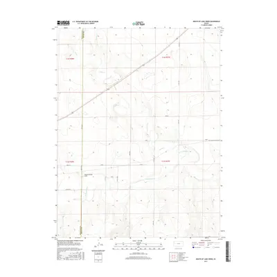
2015 Map of Mouth of Lake Creek
USGS Topo · Published 2015About this map
The Smoky Hill River winds through this High Plains landscape, a region defined by its critical transit corridors and water-carved topography. The historic Butterfield Overland Trl cuts across the eastern sections, marking the path of 19th-century mail and passenger transport before the modern road network took hold. The map reveals the intricate drainage patterns of the western Kansas terrain, where Lake Cr and Turkey Cr meet the river valley. The presence of named features like Depperschmidt Draw suggests the localized family histories that shaped the ranching and agricultural development of the region. Distinct geographic zones including Rawhide, Quail, Plains, and Osage help define the livestock and land-use divisions of Wallace and Logan counties during this mid-2010s survey.
Find a feature on this map
22 named features on this map. Tap any name to fly to it.
Don’t see what you’re looking for? This feature index may not catch every label — zoom into the map to look around manually.
Map Details
Editions of this 2015 Mouth of Lake Creek Map
This is the sole edition of this map. No revisions or reprints were ever made.
Other maps of this area

1954 · Goodland
USGS Topo · 1:250,000

1955 · Scott City
USGS Topo · 1:250,000

1956 · Goodland
USGS Topo · 1:250,000

1957 · Goodland
USGS Topo · 1:250,000

1958 · Scott City
USGS Topo · 1:250,000

1959 · Wallace
USGS Topo · 1:62,500

1959 · Harris Draw
USGS Topo · 1:62,500

1969 · Russell Springs 2 NW
USGS Topo · 1:24,000

1969 · Mc Allaster SE
USGS Topo · 1:24,000

1969 · Russell Springs 2 SW
USGS Topo · 1:24,000