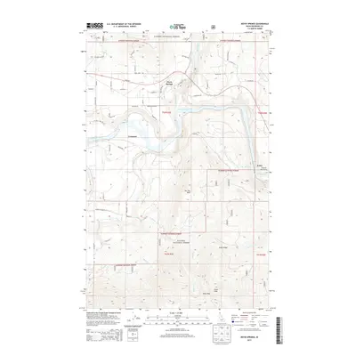
2013 Map of Moyie Springs
USGS Topo · Published 2013About this map
Moyie Springs sits at the confluence of two powerful waterways, where the Moyie River and its dramatic Moyie Falls meet the Kootenai River. This Northern Idaho landscape is dominated by the steep slopes of the Purcell Mountains, much of which is protected within the Kanisku National Forest. The map documents a rugged timber and river corridor, with the settlement of Crossport positioned along the Kootenai and the small community of Katka further east near the river's bend.
Find a feature on this map
34 named features on this map. Tap any name to fly to it.
Don’t see what you’re looking for? This feature index may not catch every label — zoom into the map to look around manually.
Map Details
Editions of this 2013 Moyie Springs Map
This is the sole edition of this map. No revisions or reprints were ever made.
Other maps of this area

1911 · Priest Lake
USGS Topo · 1:250,000

1913 · Priest Lake
USGS Topo · 1:250,000

1958 · Sandpoint
USGS Topo · 1:250,000

1963 · Sandpoint
USGS Topo · 1:250,000
1965 · Curley Creek
USGS Topo · 1:24,000

1965 · Meadow Creek
USGS Topo · 1:24,000
1965 · Leonia
USGS Topo · 1:24,000

1965 · Twentymile Creek
USGS Topo · 1:24,000

1965 · Ritz
USGS Topo · 1:24,000
1965 · Line Point
USGS Topo · 1:24,000