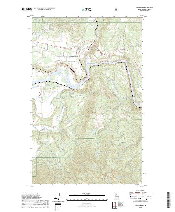
2024 Map of Moyie Springs
USGS Topo · Published 2024About this map
Moyie Springs sits at the confluence of the Moyie River and the Kootenai River, a landscape defined by significant elevation changes and hydroelectric potential at Moyie Falls. This 2024 survey documents the rugged interface between the Cabinet Mountains to the south and the Purcell Mountains to the east. High peaks such as Two Tail Peak and Katka Peak dominate the topography, while the Kaniksu National Forest encompasses the majority of the undeveloped terrain. Settlement is concentrated along the river corridors and historic rail routes, with the small communities of Crossport and Katka serving as distinct markers of human activity in this mountain pass region. Local roads like Baldy Mountain Rd and Old US Hwy 2 provide access to the timbered ridges and narrow valleys that have historically shaped the local economy.
Find a feature on this map
84 named features on this map. Tap any name to fly to it.
Don’t see what you’re looking for? This feature index may not catch every label — zoom into the map to look around manually.
Map Details
Editions of this 2024 Moyie Springs Map
This is the sole edition of this map. No revisions or reprints were ever made.
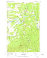
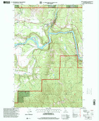
Historical Maps of Moyie Springs Through Time
3 maps found